
Just so you know: some links in this post are affiliate links. If you book through them, I may earn a small commission at no extra cost to you. I only link to things I’d tell a friend to use.
Djúpalónssandur is the black beach to pick if you want “something like Reynisfjara, but calmer”. It’s a cove of smooth black pebbles under Snæfellsjökull glacier, with old lifting stones, the rusted remains of a 1948 shipwreck and two small lagoons. Reynisfjara on the South Coast gets the fame and the tour buses. In 2026 it has also had a rough year, with storm erosion and closures. So here’s an honest comparison of the two, with this year’s parking fees and drive times, so you can choose.
The quick version
Djúpalónssandur is on Snæfellsnes, about 207 km and 3–3.5 hours from Reykjavík. Parking is the national park’s 1,110 ISK service fee per car, valid at every park car park until midnight. Reynisfjara is about 187 km and 2.5–3 hours from Reykjavík, with paid parking (about 1,000 ISK). The two beaches are about 380 km apart, so don’t try both in one day. Pick Djúpalónssandur for history and fewer people, and Reynisfjara for basalt columns and the Reynisdrangar sea stacks. Since February 2026, though, storm erosion has often limited Reynisfjara to the viewpoint. Neither beach is safe to paddle at.

Where Djúpalónssandur Is and How to Get There
Djúpalónssandur is on the south-west tip of the Snæfellsnes peninsula, inside Snæfellsjökull National Park. From Reykjavík, drive north through the Hvalfjörður tunnel to Borgarnes, then out along the south coast of the peninsula towards Arnarstapi. The turn-off is Road 572 (Dritvíkurvegur), a side road of about 2 km down to the car park.
It’s about 207 km each way. Google will say under three hours, but with a coffee stop and the odd photo it’s more like three to three and a half. Nearby stops are close: Malarrif visitor centre is about 10 minutes away, Arnarstapi about 15 minutes, and Kirkjufell around an hour on the north side of the peninsula.
Parking, Toilets and What It Costs in 2026
- Parking: Snæfellsjökull National Park charges one service fee per vehicle, paid as parking: 1,110 ISK for a car with up to five people, 1,440 ISK for 6–9 people, and 450 ISK for a motorbike (October 2026, snaefellsjokull.is). You pay once and it covers every park car park until midnight. Pay with the Parka app, the QR code on the signs, or the kiosk at Malarrif.
- Toilets: there are toilets by the upper car park, but only in summer. Malarrif visitor centre has toilets open all year, and it’s on your way.
- Food: nothing at the beach. Bring a snack, or eat in Arnarstapi or Hellissandur.
- Overnight: camping and sleeping in the national park aren’t allowed, and that includes campervans in the car park. My campervan parking guide explains the rules, and here are campsites to use instead.
What You’ll Find on Djúpalónssandur
From the upper car park, a short path runs down through a gap in the lava to the beach. Allow 10–15 minutes at a slow pace, and wear proper shoes, because it’s uneven and slippery when wet. There’s also a viewing platform that’s accessible for wheelchairs, and a smaller car park lower down by the lagoon.
The lifting stones
Just where the path meets the beach, under the rocks, you’ll find four round stones of different weights. Fishermen once used them to test new crew. The national park lists them as Fullsterkur, “full strength”, at 154 kg; Hálfsterkur, “half strength”, at 100 kg; Hálfdrættingur, “half-carrier”, at 54 kg; and Amlóði, “the useless one”, at 23 kg. The story goes that if you couldn’t lift Hálfdrættingur to waist height, onto the stone ledge beside them, you didn’t get a place on a boat. Most of that ledge is buried in sand now.
You can try them yourself. Lift with your legs, not your back, and don’t drop them on your feet. Most of us manage Amlóði with dignity and Hálfdrættingur with a lot of noise.

The Epine shipwreck
The rusted iron scattered across the beach is from the Epine GY 7, a Grimsby trawler that was wrecked east of Dritvík on the night of 13 March 1948. Rescue teams came from Arnarstapi, Hellnar and Hellissandur in a storm. One man washed ashore alive, and four more were pulled off the wreck on a line once the tide turned. Fourteen of the 19 crew died. There’s a sign about it near the path. The iron is left there as a memorial, so please don’t climb on it or take any.

The lagoons, the pebbles and Dritvík
The beach gets its name from two small lagoons behind it, Djúpalón and Svörtulón. The beach itself isn’t sand at all. It’s smooth, egg-shaped black pebbles, polished by the sea, that people call the pearls of Djúpalón. They’re beautiful and you’ll want one. Leave them: this is a national park, and if every visitor takes one, the beach won’t last.
If you have another 40 minutes or so, take the trail of about 1 km over the headland to Dritvík, the next cove. For centuries it was one of the busiest seasonal fishing stations on Snæfellsnes, and today it’s usually empty.

Is Djúpalónssandur Safe?
Safer than Reynisfjara for most people, but not safe in the way a beach at home is. This is open North Atlantic, and the same kind of sneaker waves happen here. One wave runs much further up the beach than the ones before it. There’s no warning-light system like the one Reynisfjara has, so it’s up to you. Stay well back from the waterline, don’t go out on the wet rocks for photos, keep children close, and never turn your back on the sea. Don’t paddle or swim. The pebbles shift under your feet, and the water is cold enough to take your breath away.

Reynisfjara in 2026: What’s Changed
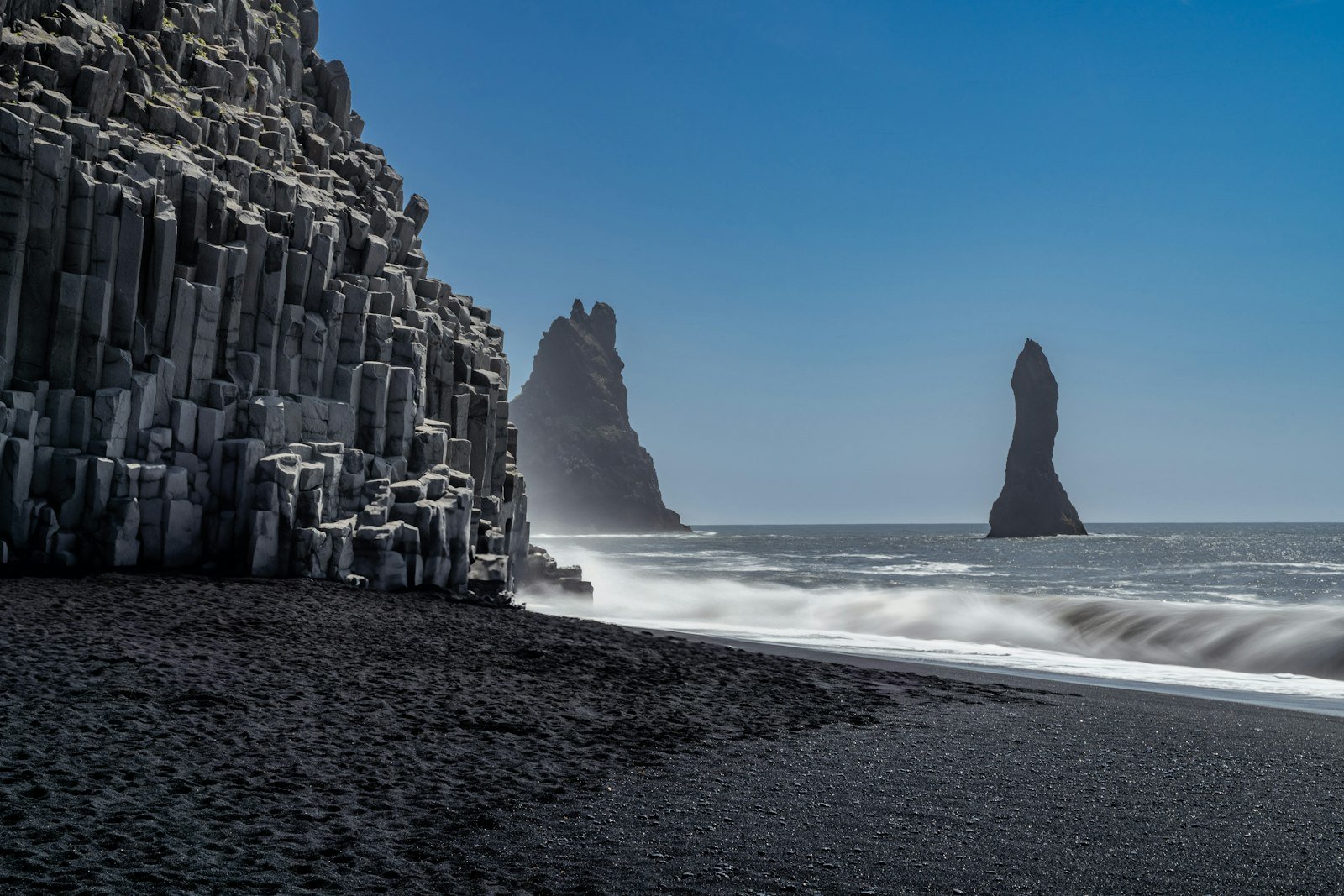
Reynisfjara is still spectacular: basalt columns, the Hálsanefshellir cave, and the Reynisdrangar sea stacks off the end of the beach. It’s about 187 km from Reykjavík, roughly 2.5–3 hours, and 10–15 minutes from Vík. I cover it as part of the South Coast in how long the South Coast drive takes, so here are just the things you need to know this year:
- Storm erosion. In February 2026, heavy seas washed away the sand under the viewing platform and destroyed the warning signs. Access was then limited to the upper beach ridge, and you couldn’t walk down to the columns (Icelandic Tourist Board). Some sand has come back since, but how far you can go depends on the sea that day.
- Closures on bad days. The landowners now close the eastern end of the beach and the lower car park when the waves are high. That happened during the storm on 14 October 2026. In mid-November 2026, Safetravel still says the beach is only accessible from the viewpoint. Check that page on the day you go.
- Why it matters. There have been six fatal accidents at Reynisfjara this century. The most recent was a nine-year-old girl in August 2025, near the basalt columns, while the warning light was yellow, not red (Iceland Monitor). Yellow doesn’t mean safe.
- Parking: paid, about 1,000 ISK at the car park nearest the beach and a bit less further back. There’s a restaurant and toilets by the car park. You can’t sleep there in a campervan.
Djúpalónssandur vs Reynisfjara: 7 Honest Differences
| Djúpalónssandur | Reynisfjara | |
|---|---|---|
| From Reykjavík | ~207 km, 3–3.5 h | ~187 km, 2.5–3 h |
| Parking (October 2026) | 1,110 ISK per car, valid in the whole national park until midnight | Paid, about 1,000 ISK |
| Beach | Black pebbles, lagoons, lava | Fine black sand, basalt columns, sea stacks |
| History | Lifting stones, 1948 Epine wreck, Dritvík fishing station | Mostly scenery and folklore about the sea stacks |
| Crowds | Busy around midday in summer, quiet early and late | Busy most of the day, all year |
| Safety | Sneaker waves possible, no warning lights | Six fatal accidents this century; warning system, closures in 2026 |
| Food and toilets | Summer toilets only; nearest food in Arnarstapi | Restaurant and toilets by the car park |
Honestly, Djúpalónssandur isn’t a secret any more. Snæfellsnes day tours stop here too, and on a July afternoon you’ll share the path. But it feels more like somewhere you’ve found. Come before 10:00 or after 17:00 in summer and you’ll often have the stones to yourself.
Can You See Both in One Trip?
On one trip, yes. In one day, no. The beaches are about 380 km apart by road, more than five and a half hours of driving with no stops, and on opposite sides of Reykjavík. Give each one its own day: Snæfellsnes as a loop from Reykjavík or Borgarnes, and the South Coast towards Vík.
If you’re budgeting for the drive, remember the per-kilometre road charge on rental cars. The rental company either bills 6.95 ISK per km for cars up to 3,500 kg, or a flat 1,390 ISK per started rental day plus any admin fee (island.is). At the per-km rate, a Reykjavík–Djúpalónssandur return of about 415 km adds roughly 2,900 ISK.
What I’d book
A car for two separate beach days
No bus goes to either beach. Compare local rental companies, and check whether they charge the road fee per km or per day.
So Which Beach Should You Pick?
- Pick Djúpalónssandur if you like a story with your scenery, want fewer people, or are already planning Snæfellsnes. Add Arnarstapi and a couple of fishing villages worth the detour, and stop in Borgarnes for a bowl of lamb soup on the way.
- Pick Reynisfjara if the South Coast is already your route and you want the basalt columns and the sea stacks. Just accept that in 2026 you may only see them from the ridge. Combine it with Dyrhólaey, which is a good puffin spot in summer.
- Got time for both? Do both, on different days, and read my road trip mistakes post before you plan two long drives back to back.
Planning South Iceland yourself? Don’t overpay on the way.
My free guide: 10 things tourists waste money on in Iceland, and what locals do instead. Prices checked October 2026.
Djúpalónssandur FAQ
Is there a fee to visit Djúpalónssandur?
The beach is free, but parking inside Snæfellsjökull National Park costs 1,110 ISK per car (up to five people) in 2026. It’s valid at all park car parks until midnight.
How long should I spend at Djúpalónssandur?
Allow 45 minutes to an hour for the walk down, the lifting stones and the wreck. Add about 40 minutes if you walk over to Dritvík.
How heavy are the Djúpalónssandur lifting stones?
154 kg, 100 kg, 54 kg and 23 kg, according to Snæfellsjökull National Park. Their names are Fullsterkur, Hálfsterkur, Hálfdrættingur and Amlóði.
Is Djúpalónssandur better than Reynisfjara?
It depends on what you want. It’s quieter and has more history. Reynisfjara has the basalt columns and sea stacks, but it has had storm damage and closures in 2026.
Can I visit Djúpalónssandur in winter?
Yes. The road is usually open, but check umferdin.is for road conditions and safetravel.is for warnings. You’ll have only a few hours of daylight, and the summer-only toilets will be closed.